Today we started from our campground in Gardiner, MT with the plan to see whatever we could see between Mammoth Hot Springs and the northeast exit of Yellowstone and between Tower-Roosevelt and Canyon Village. There really aren’t a ton of attractions along that route, so we figured we would have more than enough time, turns out we were nearly perfect on our timing, but I’ll get to that later.
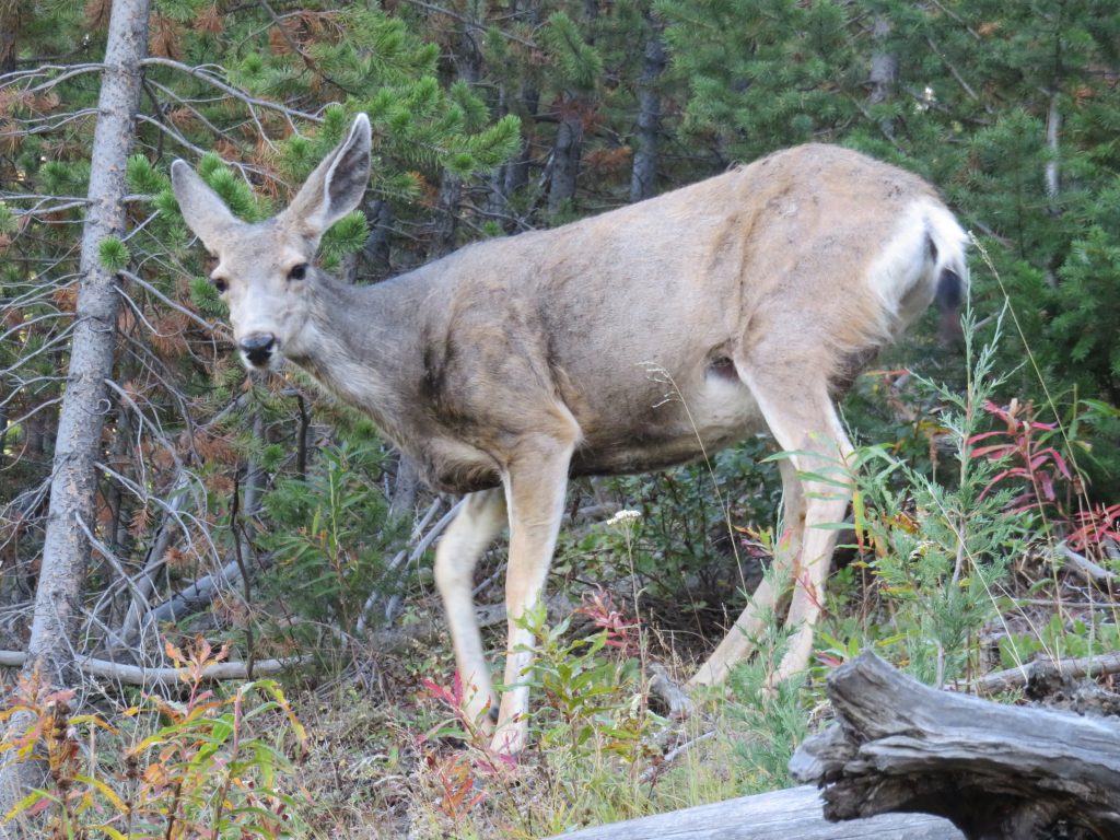
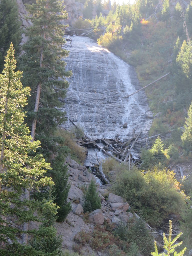
The first thing we did was hike the short 1 mile (total) trail to Wraith Falls, which were beautiful, but the hike up wasn’t particularly so, aside from the extra company we had on the hike.
And here’s the falls themselves, which we guessed get their name from the bare rock with the water shimmering down the fairly shallow slope.
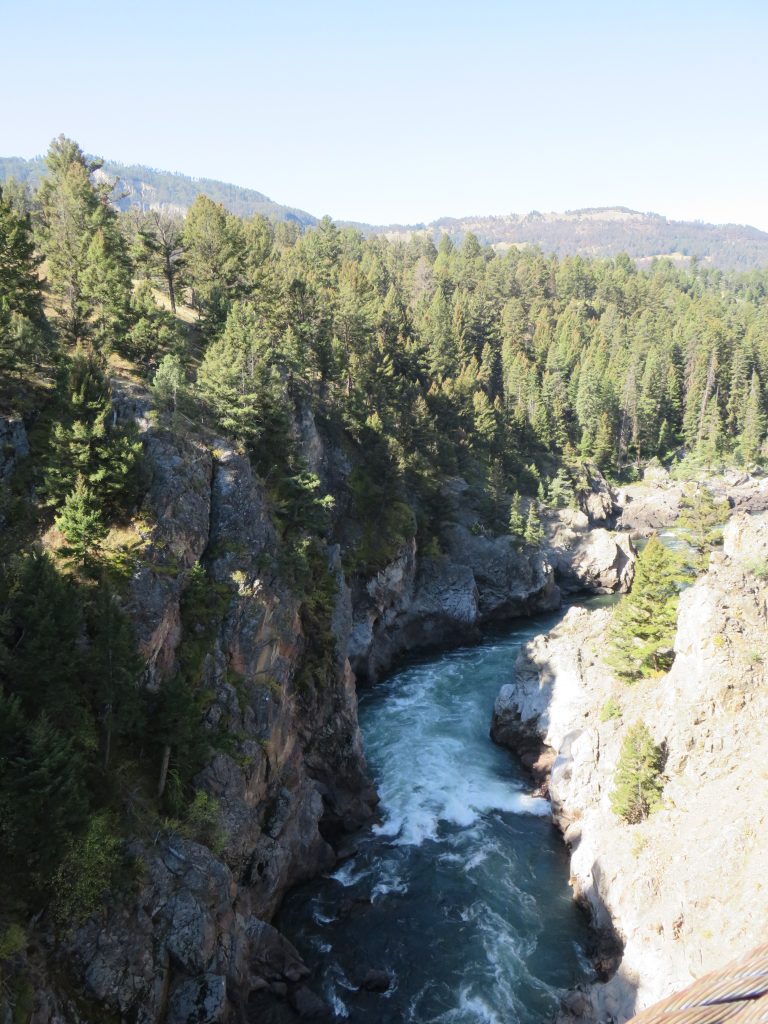
After returning to our scenic drive, we headed to the Hellroaring Creek trailhead and hiked out to the suspension bridge (2 miles total) that spans the Yellowstone River. Here’s a view from that suspension bridge.
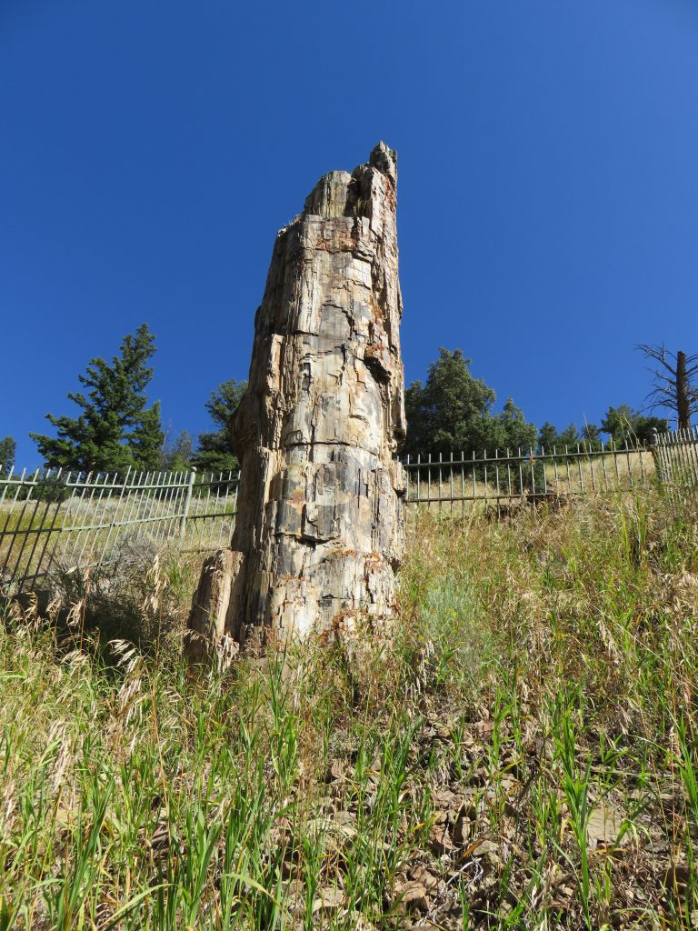
The next destination was the Petrified Tree, accessed by a side road off of the road between Mammoth Hot Springs and Tower-Roosevelt. Here’s a view of the petrified tree, which is claimed to be anatomically identical to the redwood trees in California.
After we reached Tower-Roosevelt, we headed south toward Canyon Village and spotted a nature trail just before we reached Tower Falls. The view of the Yellowstone River and associated canyon was spectacular, as seen in this panorama taken from the highest overlook.

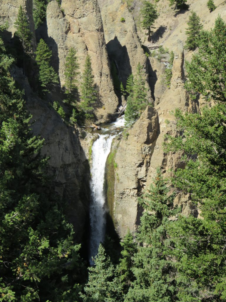
As we headed further south, the next destination was Tower Falls. The trail to the bottom of the falls has been closed for some time, so we had to settle for this vista of the top of the falls, not bad!
We then headed down to Canyon Village, since we’d only driven the road between Dunraven Pass and Canyon Village and Megan really wanted the Salted Caramel Brownie Sunday at the ice cream shop there.
After returning to new territory, the road east of Tower-Roosevelt, which lead us to the Lamar Valley. This area is known as America’s Serengeti, and for good reason. There were more bison here than there were in the rest of the park combined, at least from what we observed. This is the view from the road where we stopped to view a large herd of bison. It may be hard to see because they weren’t really that close, but each of the dark dots in the grass in the valley was a bison.

Near the end of the Lamar Valley, we encountered a trailhead and decided to take the trail out to the middle of the valley, which just so happened to be near another large herd of bison and offered a great view of the southern part of the Lamar Valley not visible from the road since it heads east from here.

Our last view of Yellowstone National Park was further up the valley from the trailhead we just took, which gave us one last beautiful glance of the park before leaving.

The remainder of the drive to our campsite, which is located in the Parkside Campground in Custer National Forest, involved a drive through the Beartooth Pass in the Beartooth Mountains. To say this drive was beautiful is an understatement. We were absolutely astonished at how beautiful this drive was, especially in the alpine region of the pass, where we thought it was just as beautiful or maybe even more so than the similar areas of Trail Ridge Road in Rocky Mountain National Park.
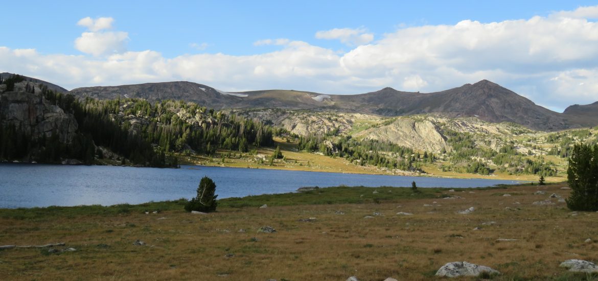
The first major site we stopped at was Beartooth Lake, which also contained a campground (for future reference) and provided a wonderful mountain-and-lake view.

The real treats were waiting for us near the Beartooth Pass itself. There were so many lakes.

Right near the summit of the pass, we saw this lake, even better than the previous one.

As we descended further into the canyon on the north side, we saw a facility built into rock jutting out into the canyon. This facility had a walkway going out to the very peak of that rock, providing at least a 270 degree view of the canyon. Here’s the panorama from that position.

All in all, we were left wondering to ourselves how this was not a national park, given that the drive was as pretty as anything we’d ever seen in any of the other national parks. The alpine area of US 212 is larger than that of Trail Ridge Road in Rocky Mountain National Park, and it even shows views of alpine lakes which Trail Ridge Road does not have. In my opinion, this is a place I could see being a national park quite easily, maybe someday it will be. For now, if you’re in the area, you should absolutely visit this place as it’s every bit as beautiful as anything you’ll see in Yellowstone.
These vistas along US 212 were all very close to the campground, which we arrived at just in time to cook dinner (burgers) and get to sleep. We stayed at the Parkside Campground in Custer National Forest, which was a very small campground with no utilities, but was quiet and right next to Rock Creek providing a soothing water rushing sound that inspired us to leave the windows open at night. A wonderful place to camp.